
By now, most of you will have received the Spring Edition 2022 of the Dataw Historic Foundation’s Tabby Times. This is the “live” version of the beautiful cover article written by Ginny Hall-Apicella.
“The wind was blowing at ten knots; the tide was low, and clouds hovered over the Morgan River when the Dataw Historic Foundation entered into a new research project using 21st-century technology. On that blustery February day, with a contingent of the DHF board watching, a drone flew high and wide to photograph and record the ruins of the Lewis Reeves Sams home, which history suggests stood on that spot. Any Dataw golfer has long seen the massive remnants of “The Chimney” peeking out of the marsh grass on MR-14, but no structure was visible. An earlier theory hypothesized that the building stood about 200 feet from the banks of the Morgan River and that the devastating Hurricane of 1893 wiped out the shoreline.
The comprehensive historical information pertaining to Ginny’s article is documented in Colin Brooker’s report. For further insights, refer to Colin Brooker’s report.
Here is the “live” coverage (i.e., excerpts of the drone video).
There’s one error in the video. For the longest time, it was believed the ruins, when intact, looked similar to the Retreat Plantation House shown in the video.
Mr. Brooker’s recent research revealed that it probably looked like the Micah Jenkins House on Wadmalaw Island near Charleston, SC.
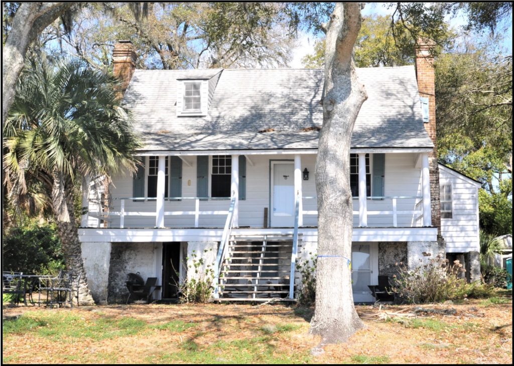
Micah Jenkins House, Wadmalaw Island, Charleston, SC. Before 1776.